.png.transform/rendition-xs/image_image%20(1).png)
Pan de Cea PGI
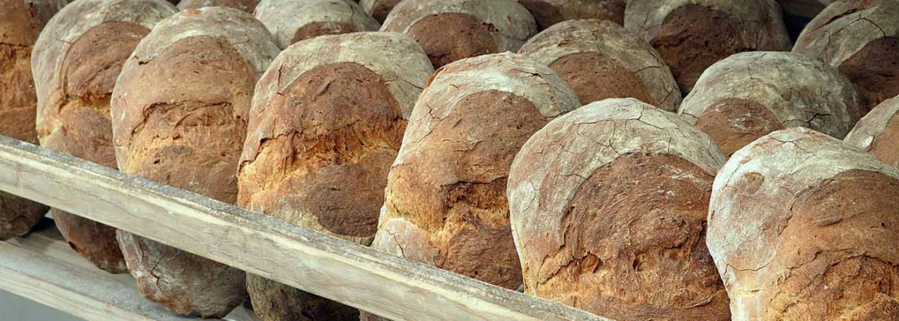
Bread made from wheat flour. Long in shape but with rounded ends and a cut across the center dividing it into two equal bulging parts joined together.
Tasting notes
The texture of the bread is spongy, fibrous and firm, with not many air pockets. These are of varying size and are distributed irregularly. Intense flavor of wheat. The crust is thick, hard and rigid, tending to flake, and has a toasty flavor.
Other notes
The weight and size depend on the type of presentation:
- Whole, or "Poia": from 1 to 1.2 kg (2 ¼ - 2 ½ lb).
- Half, or "Molete": from 0.5 to 0.6 kg (1 lb 2 oz-1lb 3oz).
- Crust thickness between 0.5 and 1 cm (0.19-0.3”).
- The crust color varies between gold and deep chestnut, and the crumb has a color similar to that of wheat grains.
Production / Processing method
The bread production process involves the following stages:
- The flour is first placed in the kneading trough and formed into a volcano shape. Salted water and mother dough from the previous batch are placed in the center. The mixture is mixed then and kneaded for a minimum of 60 minutes if done manually, or 45 if done by machine.
- The dough is then left to prove for 45 to 60 minutes, depending on the ambient conditions.
- It is then divided manually into portions weighing approximately 1.5 kg (3 lb 5 oz) or 0.75 kg (1 lb 10 oz), as required.
- These portions of dough are then re-kneaded and again left to rise for 25 to 30 minutes.
- Before baking, the loaves are slashed across the center. The ovens used for baking this bread are characteristic because of their shape, being circular, and the granite they are made from, with a spherical dome made from blocks of granite cut stereometrically to achieve the right size and thickness.
- Baking takes place in several stages, with the loaves being moved round inside the oven further away from the source of heat so that the whole batch is baked as evenly as possible.
- Once all the loaves have been placed in the oven, it is closed for a minimum baking period of 120 minutes.
- The loaves are then removed from the oven but must cool down for at least one hour on shelves made of wood or of other authorized materials so that moisture can escape before they are sold.
Geography / Relief and climate
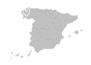
Galicia is located in the north-west of the Iberian peninsula. Owing to its position on the westernmost tip of the European Atlantic arc, it forms a geographical crossroads where different ecological domains interact – a north-south, climatic and topographical component, and a west-east component opposing maritime lands against inland areas. The difference between the north and south is more marked regarding climate and also, therefore, soils and vegetation. In spite of belonging to ‘wet Spain’, Galicia’s latitudinal position causes it to differ from other regions on the Cantabrian sea, making it more similar to sub-tropical Atlantic climates. In fact, it is a transition climate – oceanic in the north, and sub-oceanic in the south. The former is rainy and temperate, with rainfall reaching a peak in winter and a minimum in summer, when there is a degree of drought. The sub-oceanic climate, which is characteristic of the Baixo Miño ria around Vigo and Ourense, has a more marked summer drought period with at least two dry months (July and August), plenty of winter rainfall and higher annual average temperatures.
The combination of a rainy climate with Paleozoic rocks has given rise to the formation of acid, under-developed soils which, in general, are of limited usefulness. In fact, poor soils predominate in Galicia, with fertile areas being located in clearly-defined parts, generally at the base of valleys and depressions or along the coast.
However, the high rainfall and mild temperatures enable ground cover to grow fast, and cattle-rearing areas tend to be located in peneplains where moist brown soils are to be found on siliceous materials. The relief and heavy rainfall have formed the river network, with the Navia, Eo, Oro, Landove, Sor, Esteiro, Dola, Baleo, Mayor and Mera rivers along the Cantabrian north coast, and the Tambre, Ulla and Miño rivers, the longest and largest, on the Altantic coast, where there are also other smaller rivers such as the Eume, Mandeo, Aliones, Mira, Umia, Lérez, etc. which flow into the rias, both the Rias Altas and the Rías Baixas. Mention should also be made of the Támega in the south-east of the region in the province of Ourense, which does not belong to the northern basin but to the Duero river basin.
Regulatory Council
Consejo Regulador de la IGP Pan de Cea
Praza Maior, 1
32130 San Cristovo de Cea (Ourense)
Tel: (+34) 618 265 307
info@pandecea.org
www.pandecea.org
Sources:
- Spanish Ministry of Agriculture
The crust color varies between gold and deep chestnut.


- Pan de Cea 1
- Pan de Cea 2

San Cristovo de Cea (Galicia)
